
| Town
Branch Neighborhood |
|
| News & Views Archives |
|
| Outdoor Recreation |
|
| Language Lane | |
| Louisiana
Tech University |
|
| University of Arkansas |
|
| Photo Albums | |
| Resource Links |
|
| About Us / Our Friends / Family |
|
|
Posted 12/12/04
|
|||||
| Despite three years of planning, Aspen Ridge development far from perfect: Questions about construction in watershed of Town Branch remain unanswered |
|||||
|
The stealth project finally became public, but the people most concerned about it easily could have missed the announcement on the front page of a local newspaper. The name was changed to suggest something totally different from the reality.
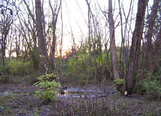
Aspen Ridge isn't something on the minds of people in Northwest Arkansas unless they are considering a ski trip to the western United States. Aspen Ridge Town Homes, however, was the name of Hank Broyles' proposal to convert 28 wooded and prairie wetland acres along both sides of the Town Branch of the West Fork of the White River in south Fayetteville into an expensive neighborhood of condominiums. A registered letter was delivered to owners of adjacent property on South Hill Avenue and South Duncan Avenue on Nov. 4, 2004, alerting them that the plan would be taken before the subdivision committee of the Fayetteville Planning Commission on Dec. 2, 2004, and to the full planning commission on Dec. 13, 2004. It took a visit to the office of the Fayetteville planning division, however, to find out that the plan would first be shared with the Plat Review Committee in a 9 a.m. meeting Wednesday, Nov. 17. It took further research to learn that the park advisory board would review the plan at a meeting at 5 p.m. Nov. 8. Plat review is where representatives of utility companies that provide natural gas, electricity, cable television and telephone service meet with people from many city departments, such as streets, water and sewer, parks and recreation and engineers and planning specialists under the oversight of members of the planning commission. The idea is to discuss problems and concerns of the professionals with little opportunity for public input. The plan has been developing for more than two years and numerous city employees, the mayor, some council members and others have had input, but the only meeting that involved public input was in April, when Hank Broyles and Hal Forsyth represented their Town Creek Development project at a meeting of the Town Branch Neighborhood Association. The plan has grown and developed tremendously since then. At that meeting, Broyles and Forsyth shared only a concept drawing of the eastern half of the project, known as Phase I. While the architect's drawings and construction plans for the multi-unit condominium buildings (at that time called Town Homes) may be the same, the configuration of the buildings and the portions of wetland to be dredged and filled have changed. Phase II (west of the Town Branch) has been added. There are some good parts in the plan. Most of an acre on the south end of the project 's Phase II will be dedicated as a city park adjacent to the north edge of the 2.46-acre parcel of wetland prairie that the city's task force on trees and trails recommended for preservation. The City Council voted in September to follow the recommendation and pledged $50,000 from the Steele Crossing tree-preservation settlement to help the Town Branch Neighborhood Association purchase the 2.46 acres. The association has until May 1, 2005, to find the remaining $75,000 to complete the purchase. If not, the tree, trail task force money will go to the north side of Fayetteville to purchase land along Scull Creek, a tributary of Mud Creek on its way to Clear Creek and the Illinois River. A grant application has been submitted for another $50,000 and members of the neighborhood association had by early December pledged $6,000 to help purchase the 2.46 acres for preservation. The combination of the natural area and the developer's park dedication would create more than 3 total acres of public neighborhood greenspace for the enjoyment of the condominium dwellers and other visitors from all over the city. On the downside, there is a tremendous problem managing stormwater runoff from the proposed development area. The Town Branch receives all the runoff from a vast portion of the University of Arkansas campus. There is no detention area on that part of the campus, so floods are magnified each time another inch of soil is paved or covered by a building. Numerous buildings, several streets and driveways and parking areas are planned for the Aspen Ridge development, all of which will reduce the absorbent surface of the land and speed runoff. That means that the drainage of the area is the most difficult part to plan. As proposed to the city, the development would include buildings and streets in a flood plain on the east side of the Town Branch between 11th Street and what was formerly an east-west rail line slated to become part of the city's trail system. That wooded wetland area on the east side of Town Branch was inundated by several feet of water three different nights in 2004, once in late April and twice in early July. The water flowed over 11th Street and over 15th Street and flooded one house severely and was up to the floor of others. Some houses were surrounded by water on Ellis Ave., which is the southeastward extension of Hill Ave., but water didn't actually enter those houses. All backyards along the Town Branch on Duncan, Hill, Ellis and Van Buren avenues and 15th street between 11th and 15th were at least partially flooded. The wooded wetland on the east side of Town Branch north of 11th Street emptied slowly and prevented the flooding from being even worse. If it is filled and built upon, the effective water-carrying capacity of the stream will be greatly decreased and the level in the stream will rise to a dangerous level south of 11th Street. The problem for the developer is that the delineation of the flood plain provided by the Federal Emergency Management Administration fails to include a significant portion of land that flooded in April and July of 2004. That portion of the floodplain may not have been mapped by FEMA officials for the same reason most people who live nearby or drive adjacent streets do not realize it is part of the floodplain: It can't be seen from the roads or the nearby homes on Hill Avenue. Walking the stream bed, a person can see that the east shore is lower than the west shore but cannot see the extent of the flood-prone area on the east without climbing out and exploring it. Much of the area is lower than the stream bank itself. The whole area is essentially a slough parallel to the creek that is part of the creek after heavy rain such as occurred on the three nights cited. Site out of sight, out of mind! When the Fayetteville Planning Commission and City Council visit development sites, they don't normally get out of the tour bus and walk the land, at least not the parts that aren't readily accessible. Walking north and south at a distance of more than 100 feet east of the Town Branch west of Hill Avenue between 11th Street and Sixth Street, a person can't help seeing that most of the land around him is wetland, and evidence that the stream overflows there is apparent by the type of trees, understory vegetation and ground cover. And except for the driest times of the year, standing or slowly flowing water is always visible. Only a 2-foot-wide outlet releases the normal flow to the Town Branch less than 100 yards from 11th Street, where the stream grew to a width of nearly 100 yards and covered the street and bridge each of the nights cited in 2004. FEMA officials obviously never actually studied that hidden acreage. And the people who provide ultimate approval of development of that acreage MUST NOT make that same mistake. Bentonville has received a large grant to fund a study of its floodplains to determine their current configuration after several years of development. FEMA floodplain maps are often found to be incorrect or out of date all over the United States. Fayetteville planning commissioners and aldermen, U.S. Corps of Engineers officials, representatives of the Arkansas Department of Environmental Quality and others must actually visit the land along the east side of Town Branch to see for themselves that it functions as a flood plain. If that area is filled and the five buildings slated for the area are constructed, the Town Branch's overflow area will be reduced drastically and flow will be much faster when the stream is out of its banks and damage and siltation downstream will be much more likely than in the past. A newspaper article published Dec. 8 reported that only 12 of 56 developers cited by the Arkansas Department of Environmental Quality for Stormwater management violations earlier in 2004 have agreed to pay proposed fines and that some have not even acknowledged the problems. Some of the developments cited are only a mile away on the western arm of the Town Branch of the West Fork of the White River. Members of the Town Branch Neighborhood Association do not want the developers of the Aspen Ridge site to be on the list of violators in 2005 or 2006. We would like to see further study to determine how the watershed can be protected BEFORE a single shovelful of dirt is moved in the Town Branch watershed. Filling the wooded wetland along the east side of Town Branch between Sixth and 11th streets is obviously inappropriate and potentially dangerous and more expensive than leaving it alone to do its work as a part of the flood-prevention system. Opening 12th Street Would Violate Previous Agreement The Aspen Ridge development's southwestern connection to the city street system currently is proposed to run south on the route of a long-ago platted Brooks Avenue. Because the portion of the platted street south of 12th Street was vacated by the city in 1993, it would be connected to 12th Street to the east rather than running south to 15th Street, the logical choice. However, it is within reach for the city, the developer and the owner of the land between 12th and 15th to reclaim the platted route to connect with the existing portion of Brooks at 15th Street and offer a convenient outlet to U.S. 71 B (S. School Ave.), Razorback Road and Interstate 540. Many years ago, when the small existing portion of 12th Street was paved, an agreement was reached to create an unpaved turnaround area at the west end of 12th but NEVER to allow extension of 12th to the west. Property owners on that part of 12th immediately west of South Duncan Avenue were promised the street would never be opened and have based many decisions on that promise over the years. That gentlemen's agreement should be honored by the current city administration. If not, the two outlets of traffic from the western portion of the Aspen Ridge development would connect to South Duncan Avenue only two blocks apart! Tree preservation plan disappointing Aspen Ridge would preserve many large trees but would remove many more. A look at the aerial photo maps provided on the city Web site shows that a high percentage of the area is canopied by mature trees. According to the developer's report, however, only 14.05 acres of the 26.751 acres are canopied. Even so, that is listed as 52.5 percent of the site. The plan states the following: "Although the minimum percentage (25 percent) of preserved canopy is NOT being met, many of the trees proposed for removal are in poor condition ... . Due to (alleged poor condition of the trees on much of phase I) and limiting factors with regards to grading of the site, the desired preservation area for continued and permanent tree protection is along the riparian corridor." That sounds good, unless a person recognizes that trees designated as in poor health by experts are in many cases dying at an extremely slow rate, likely to stand for many years and provide shade and habitat for birds and wildlife and help mitigate other damage inevitable when land is developed. Trees in the wetland overflow area discussed above as not included in FEMA's floodplain delineation but as obviously a part of the creek's flow and backwater area during floods such as the three that occurred in 2004 are water tolerate enough to survive the nearly perpetual moistness of the soil and should ALL be preserved with the possibility of the planting of bald cypresses, tupelo gum trees and certain species of water-tolerate oaks in the area to provide even greater habitat value and erosion prevention. The value of the timber in that overflow area on the east (phase I) outweighs the value of the upland species of trees shown in a tree preservation area at the northwest corner of the west (phase II) area. The cedar grove in that area near the railroad may have less year-round value as habitat for songbirds and other wildlife than does the overflow area. However, a recent visit to that area between sunset and dark showed that the hardwoods and evergreens in that area provide roosting habitat for numerous doves, cardinals and hundreds of robins. It is clear that preserving as much as possible of all types of vegetation is important. The 10-foot cedars, for instance, are the roosting choice for many of the doves, which are among the species that also nest in low, understory vegetation. The robins seem to favor the taller, leafless hardwoods, at least on still, clear nights. Basically, so many details of this plan deserve further study and public airing that approving the Aspen Ridge PZD in the winter 2004-2005 appears to be a potential major mistake.
|
|||||
[Click here to email Aubrey]
Aubrey
James Shepherd
Fayetteville, AR © 2003, 2004, 2005
Site design by Lauren Hawkins' LDHdesign